FireVox
Aerial Intelligence for Fire & Emergency Response.
When a fire or emergency happens, conditions can change quickly.
Emergency teams need information — where the heat is, how the situation is developing and which areas are difficult or dangerous to reach.
FireVox is being developed to provide that information from above, helping emergency teams gain greater visibility and situational awareness when it matters most.
Critical Situations Need Clear Information.
Fires and emergencies can spread quickly, often in areas that are difficult or dangerous to access.
Emergency teams need a clear understanding of what is happening before they can make informed decisions.
FireVox is being developed to provide aerial intelligence that helps teams:
- Identify heat sources and hotspots
- Understand how an incident is developing
- Monitor difficult-to-access areas
- Assess affected zones
- Support emergency planning
- Make better-informed decisions
HOW FIREVOX HELPS
From Information to Better Decisions.
FireVox provides aerial data that can help emergency teams respond faster, operate more safely and understand situations more effectively.
01
Identify & Monitor
Identify heat sources and monitor their development from above.
02
Understand the Situation
Use visual and thermal information to build a clearer picture of an incident.
03
Reach Difficult Areas
Provide aerial visibility over areas that may be difficult or dangerous for emergency personnel to access.
04
Support Coordination
Provide information that can support emergency response planning and coordination.
05
Improve Safety
Help emergency teams gain better situational awareness before entering challenging environments.
FIREVOX PRODUCT RANGE
Aerial Platforms for Different Missions.
The FireVox range is being developed to support different emergency-response scenarios from thermal detection and situational awareness to aerial intervention, long-duration monitoring and search & rescue.
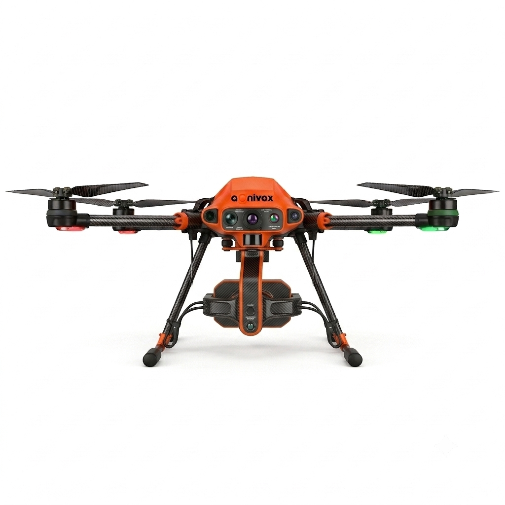
F1
Thermal Fire Detection
An aerial platform combining visual and thermal information to help identify and monitor heat sources and affected areas.
Applications:
- Fire detection
- Thermal monitoring
- Hotspot identification
- Incident assessment
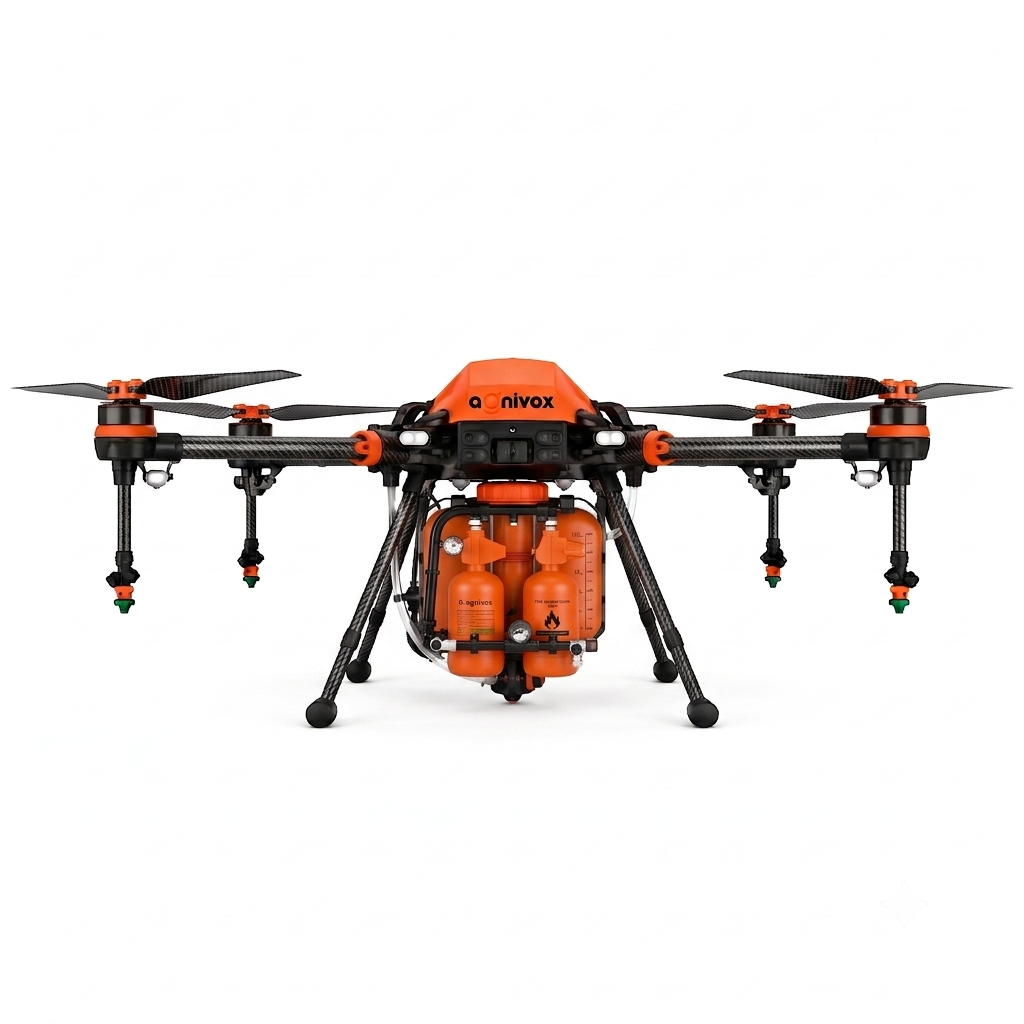
F2
Aerial Intervention
A larger platform being developed for controlled aerial intervention and suppression applications.
Applications:
- Aerial intervention
- Targeted payload delivery
- Fire suppression support
- Emergency operations
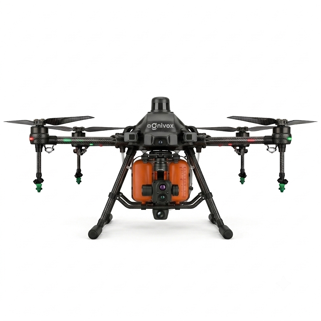
F3
Heavy Fire & Emergency Response
A higher-capacity platform intended for demanding firefighting and emergency-response applications.
Potential Applications:
- Industrial fires
- Warehouse fires
- Forest-fire reconnaissance
- Disaster response
- Large-area thermal monitoring
- Emergency payload delivery
- Future aerial suppression
TETHERED
Long-Duration Monitoring
A tethered aerial platform concept for applications requiring extended aerial observation.
Potential Applications:
- Continuous incident monitoring
- Event surveillance
- Extended aerial observation
- Emergency communications support
SAR
Search & Rescue
Aerial support for locating and observing people or areas that are difficult or unsafe to access.
Potential Applications:
- Search operations
- Disaster-area surveillance
- Missing-person searches
- Remote-area reconnaissance
AI & THERMAL INTELLIGENCE
See More. Respond Better.
FireVox combines thermal imaging, high-resolution visual data and intelligent analysis to provide a clearer understanding of emergency situations.
The system is being developed to help identify heat sources, monitor fire spread and provide aerial information for faster and more informed response.
Core Capabilities
See the Heat. Understand the Situation.
FireVox combines thermal imaging, real-time aerial feeds and intelligent analysis to help emergency teams identify heat sources, monitor changing conditions and assess affected areas. By transforming aerial data into actionable insights, FireVox aims to support faster decisions, better situational awareness and safer emergency response operations.
Thermal Imaging
Detect and visualise heat sources that may not be visible through conventional cameras.
Hotspot Detection
Identify areas of elevated temperature for closer monitoring.
Live Aerial Feed
Provide real-time visual information from above.
Thermal Mapping
Create aerial thermal views to understand affected areas.
Situational Awareness
Give emergency teams a clearer picture of changing conditions.
DEVELOPMENT APPROACH
FireVox Is Being Developed in Stages.
FireVox is being developed through a phased approach focused first on aerial intelligence, thermal detection and situational awareness.
More advanced suppression capabilities will be developed progressively, subject to engineering validation, testing and applicable regulatory approvals.
STAGE 01
Aerial Intelligence
Thermal detection, visual monitoring and situational awareness.
STAGE 02
Expanded Operations
Additional operational capabilities and mission-specific payload options.
STAGE 03
Advanced Intervention
Advanced suppression capabilities and larger-scale emergency applications.
TECHNICAL SPECIFICATIONS
Engineering Targets for Real-World Operations.
The specifications below are initial engineering targets for product development and may change following prototype development, testing, validation and certification.
F1
Thermal Detection & Emergency Intelligence UAV
The FireVox F1 is designed as an aerial intelligence platform for thermal detection, situational awareness and emergency response.
| Parameter | Proposed Specification |
|---|
Sensors
- Radiometric thermal camera
- 4K RGB camera
- Optional zoom camera
- GNSS/RTK
- Obstacle sensors
- Downward terrain sensor
Key Features
- Thermal hotspot detection
- Fire-area monitoring
- Night operation
- Live video
- Thermal mapping
- GPS coordinates
- Emergency mission planning
- Automated return-to-home
- Incident recording
F2
Aerial Fire Intervention UAV
A larger platform being developed for controlled aerial intervention and suppression-support applications.
| Parameter | Proposed Specification |
|---|
Sensors
- Radiometric thermal camera
- 4K RGB camera
- Long-range zoom
- Laser rangefinder
- GNSS/RTK
- Obstacle radar
- Optional gas/smoke sensors
Key Features
- Thermal hotspot detection
- Live thermal video
- Fire perimeter mapping
- Emergency reconnaissance
- Payload release/control
- Precision flight
- Automated mission planning
- Return-to-home
- Emergency landing
- Operator telemetry
F3
Heavy Fire & Emergency Response UAV
A high-capacity platform intended for demanding firefighting and emergency-response applications.
| Parameter | Proposed Specification |
|---|
Sensors
- Long-range thermal camera
- High-resolution RGB camera
- Optical zoom
- Laser rangefinder
- RTK
- Radar
- Optional gas/smoke sensors
Potential Applications
- Industrial fires
- Warehouse fires
- Forest-fire reconnaissance
- Disaster response
- Large-area thermal monitoring
- Emergency payload delivery
- Future aerial suppression
Status: Advanced development / future platform.
GET IN TOUCH
A Safer Tomorrow Starts with Better Information.
Whether you are a government agency, emergency service, industrial facility, disaster-response organisation or technology partner, we’d be happy to discuss how FireVox could support your requirements.