IndusVox
Industrial Intelligence from the Sky.
Industrial assets need regular inspection. Power lines, telecom infrastructure, solar installations, construction sites and industrial facilities can cover large areas and often require people to work in difficult environments.
IndusVox brings inspection into the air.
Using high-resolution cameras, thermal sensors, RTK, LiDAR and intelligent analysis, IndusVox is being developed to help organisations inspect assets faster, identify potential issues and gather better information for maintenance and planning.
INDUSTRIES WE SERVE
Across Critical Industrial Sectors.
IndusVox is being developed to support inspection and surveying operations across a wide range of industries, helping organisations gather accurate information, improve safety and make better decisions.
01
Power & Utilities
Inspect power lines, substations and utility infrastructure with aerial imaging and data collection.
02
Telecom
Monitor towers, communication infrastructure and distributed telecom assets.
03
Solar
Inspect solar installations and identify potential thermal anomalies using specialised imaging technologies.
04
Construction
Support project monitoring, site inspection, surveying and progress tracking.
05
Industrial Facilities
Inspect plants, equipment, pipelines and critical infrastructure across demanding environments.
INDUSVOX PRODUCT RANGE
A Platform for Every Inspection Need.
The IndusVox range is being developed to support different industrial inspection and surveying applications — from general visual inspection to thermal monitoring, power and telecom inspection, LiDAR mapping and specialised heavy-lift missions.
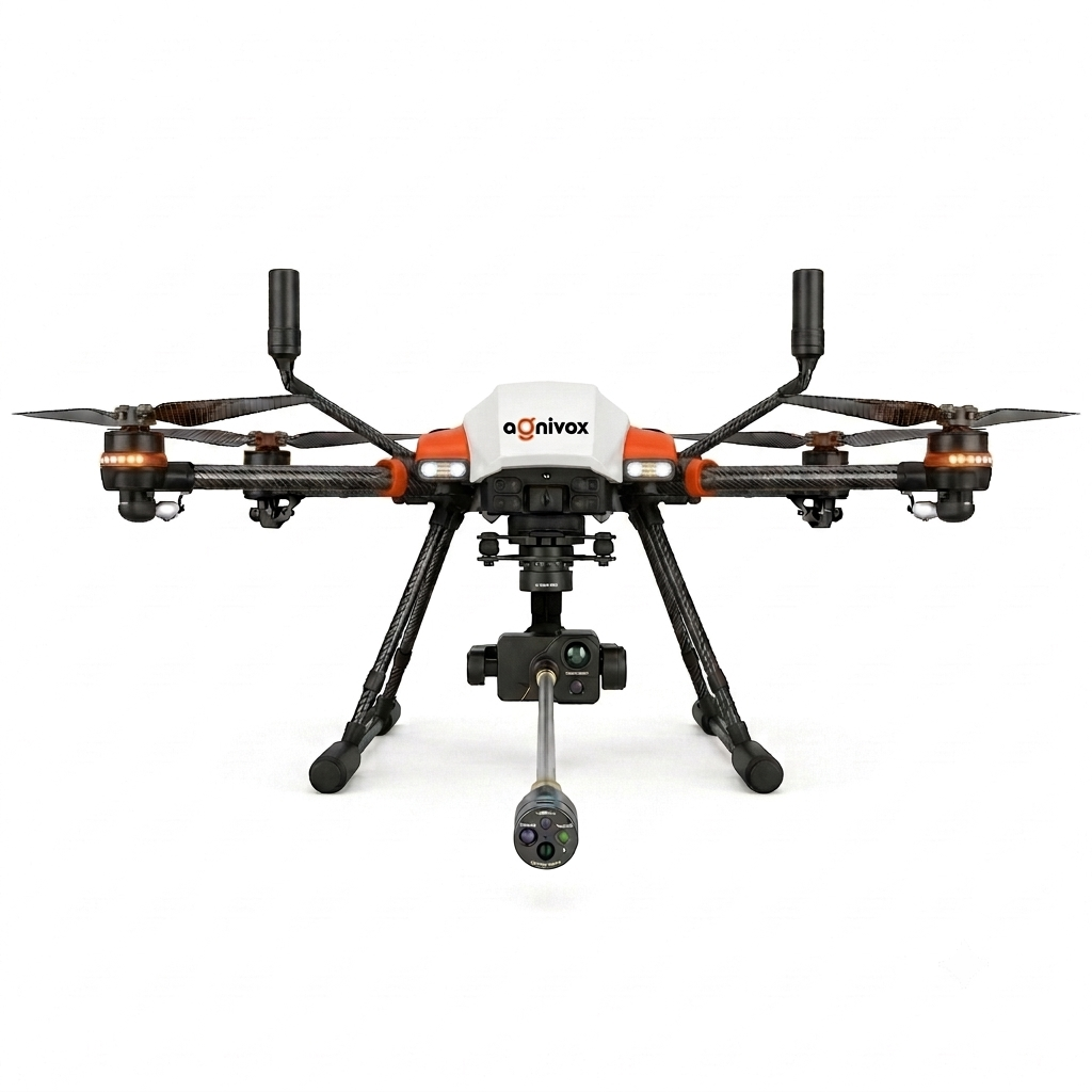
I1
General Inspection
A versatile platform for visual inspection and infrastructure monitoring.
Key Applications:
- Infrastructure inspection
- Asset monitoring
- Industrial facilities
- General surveillance
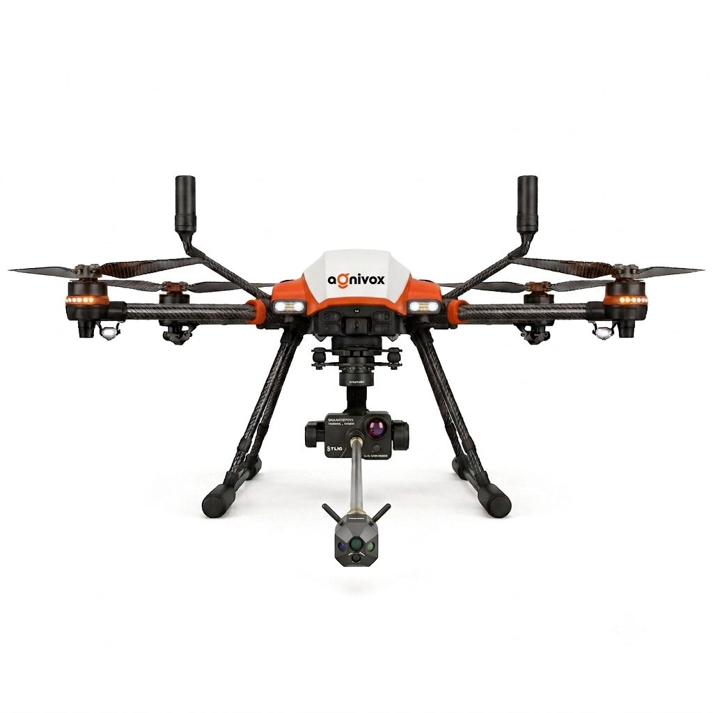
I2
Thermal Inspection
Combines thermal and visual imaging for applications where temperature information matters.
Key Applications:
- Solar inspection
- Electrical assets
- Industrial equipment
- Thermal anomaly identification
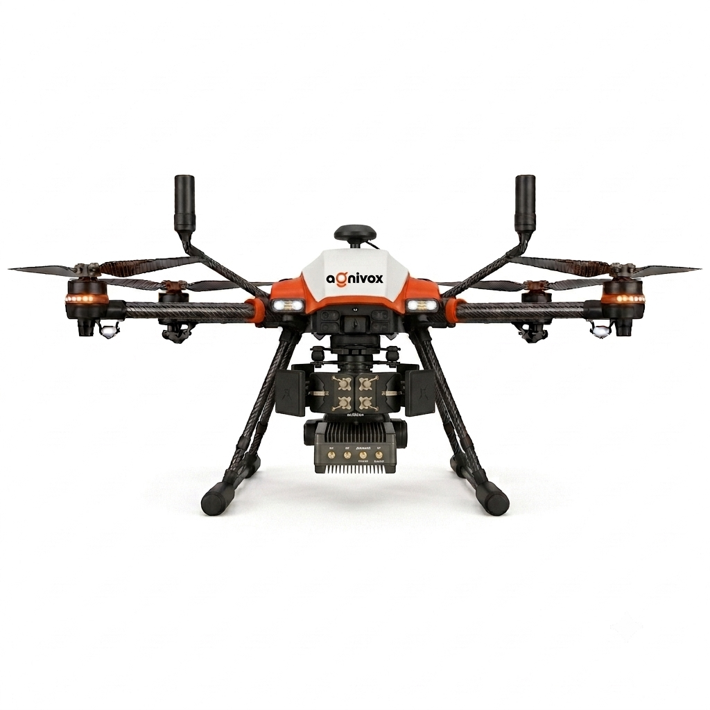
I3
Power & Telecom
Designed for inspection of distributed utility infrastructure.
Key Applications:
- Power lines
- Telecom towers
- Utility assets
- Infrastructure monitoring
I4
LiDAR Survey & Mapping
A higher-precision platform for surveying, mapping and three-dimensional data collection.
Key Applications:
- Land surveys
- Construction
- Infrastructure
- Topographical mapping
- 3D mapping
I5
Specialist Heavy-Lift
A larger platform designed to carry specialised and higher-capacity payloads for demanding missions.
Key Applications:
- Specialised payload operations
- Large-area inspection
- Industrial applications
- Custom mission equipment
HOW INDUSVOX HELPS
From Inspection to Better Decisions.
IndusVox is being developed to help organisations collect high-quality aerial data, identify potential issues and make informed decisions about maintenance, operations and planning.
By combining advanced imaging, sensing technologies and intelligent analysis, we aim to make industrial inspection safer, more efficient and more data-driven.
Improved Safety
Reduce the need for manual inspection in difficult-to-access or hazardous environments.
Faster Inspections
Cover large areas and distributed assets more efficiently.
High-Quality Data
Capture accurate visual, thermal and three-dimensional information.
Early Issue Detection
Identify potential problems that may require closer inspection or maintenance.
Better Decision-Making
Support maintenance planning, asset management and operational decisions with useful aerial data.
INTELLIGENT AERIAL SYSTEMS
More Than Just Aerial Imaging.
IndusVox combines aircraft engineering, advanced sensors, precision positioning and intelligent data processing to turn aerial observations into useful industrial information.
High-Resolution Imaging
Capture detailed visual information for inspection and asset monitoring.
RTK Positioning
Support precise positioning and georeferencing for inspection and mapping workflows.
Thermal Intelligence
Identify temperature variations that may indicate potential issues.
LiDAR & 3D Mapping
Collect spatial data for terrain modelling, surveying and three-dimensional visualisation.
Intelligent Analysis
Support the identification of potential anomalies and help organise aerial data for further assessment.
Integrated Payloads
Adapt aerial platforms to different inspection and data-collection requirements.
TECHNICAL SPECIFICATIONS
Engineering Targets for Real-World Operations.
The IndusVox range is being developed around different payload capacities, flight requirements and sensing technologies to support a variety of industrial missions.
The specifications below represent initial engineering targets for product development and may change following prototype development, testing, validation and certification.
I1 — General Inspection UAV
Versatile Aerial Inspection Platform
The IndusVox I1 is being developed as a relatively compact enterprise UAV for visual inspection, infrastructure monitoring and general aerial data collection.
| Parameter | Proposed Specification |
|---|
Sensors
- 4K camera
- Optical zoom
- RTK
- Obstacle sensing
- Optional laser rangefinder
Key Features
- Automated inspection routes
- Waypoint missions
- High-resolution imaging
- Zoom inspection
- RTK asset positioning
- Automated return-to-home
- Inspection data recording
- Live video
I2 — Thermal Inspection UAV
Visual & Thermal Intelligence
The IndusVox I2 is being developed for inspection tasks that benefit from combining conventional visual imaging with thermal information.
| Parameter | Proposed Specification |
|---|
Sensors
- Radiometric thermal camera
- 4K RGB camera
- Optical zoom
- RTK positioning
- Laser rangefinder
- Obstacle sensors
Key Features
- Thermal anomaly detection
- Solar-panel inspection
- Electrical inspection
- Industrial asset inspection
- Temperature measurement
- Automated inspection routes
- Thermal reporting
I3 — Power & Telecom Inspection UAV
Precision Inspection for Distributed Infrastructure
The IndusVox I3 is being developed for inspection of power lines, telecom towers and utility assets that require accurate imaging across distributed locations.
| Parameter | Proposed Specification |
|---|
Sensors
- Long-range optical zoom
- Radiometric thermal camera
- RGB camera
- RTK positioning
- Laser rangefinder
- Obstacle radar
Key Features
- Power-line inspection
- Telecom tower inspection
- Thermal anomaly detection
- Zoom inspection
- Automated asset routes
- AI-assisted defect identification
- Inspection database
- Geotagged imagery
I4 — LiDAR Survey & Mapping UAV
High-Precision Aerial Data Collection
The IndusVox I4 is being developed around surveying accuracy, mapping requirements and specialised payload integration.
Its intended applications include land surveying, construction monitoring, infrastructure mapping and three-dimensional data collection.
| Parameter | Proposed Specification |
|---|
Sensors
- LiDAR scanner
- RGB mapping camera
- RTK/PPK
- IMU
- GNSS
- Optional multispectral camera
Key Features
- Point-cloud generation
- 3D terrain modelling
- Digital elevation models
- Topographic mapping
- Corridor mapping
- Construction surveying
- Stockpile measurement
I5 — Specialist Heavy-Lift Industrial UAV
Designed for Specialised Payloads
The IndusVox I5 is being developed as a larger industrial UAV with a modular payload architecture to support demanding inspection and specialised aerial missions.
| Parameter | Proposed Specification |
|---|
Payload Options
The I5 is designed around a proposed quick-change payload architecture supporting:
- LiDAR systems
- Thermal cameras
- High-resolution cameras
- Multispectral cameras
- Gas sensors
- Mapping systems
- Communications equipment
- Specialised industrial sensors
- Heavy inspection payloads
Key Features
- Specialised industrial inspection
- Large-area asset monitoring
- Custom sensor integration
- Advanced mapping missions
- Mission-specific industrial operations
GET STARTED
Smarter Inspections. A Safer, More Efficient Tomorrow.
Whether you are an industrial operator, infrastructure owner, EPC company, government agency or surveying professional, IndusVox is being developed to support your inspection and data-collection requirements.
Let’s explore how aerial technology can improve your operations.